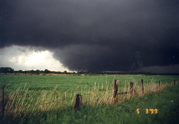
 May 3, 1999 Moore F5 tornadoPhoto: Mike Eilts, National Severe Storms Laboratory · Source · Public domain. Resized for display; WebP conversion.
- Location
- Bridge Creek–Moore, Oklahoma
- Official rating
- F5 Damage-based rating
- Local time · 3 May 1999
- 18:26–19:48 CDT (UTC−5)
- UTC
- 1999-05-03 23:26 – 1999-05-04 00:48 UTC
- Time on the ground
- 82 minutes
- Track length
- 38 mi
- Maximum width
- 1,760 yd
- Damage wind category
- F5 damage category
Event & radar context
The later NWS tornado table gives 17:26–18:48 CST (18:26–19:48 CDT); an older narrative starts three minutes earlier. Surrounding scans cover both accounts. This event used the original Fujita scale. RhoHV did not exist in this radar archive.
Interpreting the rating
F, EF and IF are different damage-rating scales. Original source labels are preserved. Badge colours group the numerical categories for browsing; they do not imply identical wind thresholds. Radar products do not directly establish the damage rating.
Event facts: National Weather Service review ↗